
In the past, I’ve talked a lot about maps and their utility as more than just an image of the ground the players will be traversing. Maps can tell stories, pass on world-building information, and more. But what does a map like that look like for a contemporary or sci-fi game? Let’s dive in!
Background
Making a map for a modern or sci-fi game seems easy at first. After all, it’s just a regular map right? Sure, but that’s the most basic approach that you can take. It’s not a bad approach, but it’s not going to add a lot to your game, capture player interest, or increase immersion. It also doesn’t do much to help tell a story. But it’s okay, because I’m a fan of motorsports and road trips, and there’s some alternatives you can use that can improve your map game! One note for all of this is that most of these work best as physical maps, and are okay but not great in digital format. This is a challenge with maps in general, but most of these maps need physical more than usual.
The Roadside Diner Map
This map is great for any kind of situation where you need to communicate local information, clues, or introduce potential NPCs and local connections, then the roadside diner map is a great way to do it! These maps typically cover a local area or a region, and can be accompanied with advertisements on the map side, or on the back for a double-sided placemat. Myself, I’ve found these kinds of maps are the best for contemporary supernatural or horror type games. Even if the player characters are in the same location, you can use them to track changes and developments, and throw some sort-of-subtle hints at them. These maps can pop up in any area, but I find they work best in smaller cities, and in rural and semi-rural contexts.
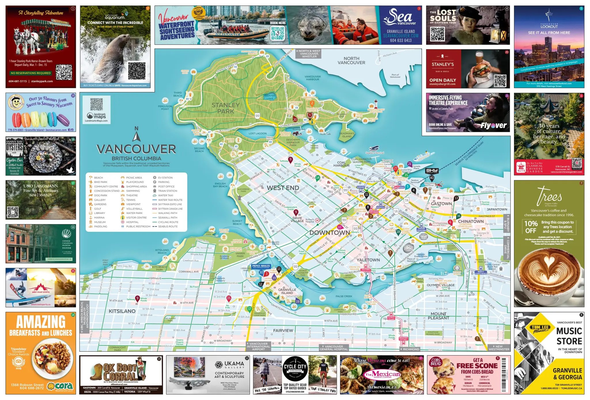
The Tourism Tri-Fold
This map is a phenomenal format for when you want to lay out a city or specific neighbourhoods, conservation park or wilderness area, theme park, or small region and do it in a way that blends modern mapping looks with activities, sites, and businesses. It’s a lot like the roadside diner map, but more corporate and official. And also, they’re generally more specific. And by that I mean you can make multiple maps like these for the same area, catering to different needs and groups, creating a cool overlapping effect and opening up some interesting story development options. In my experience, these are great for when the player characters arrive in a new city or other big location that has tourist draws and a lot of information that needs to be communicated quickly to get them immersed and familiar with the situation they’re in. They also save me, as the GM, time from having to invent meetup spots, introduce key locations, media and entertainment to check out, and try to explain the whole local scene verbally.

The Rally Race Map
Rally is one of the coolest, and in my opinion, one of the most interesting and fun to watch types of racing. It also generates maps that have “useful for game night” written all over them. Not literally, but you know what I mean. These maps are effectively superimposed over a conventional road or topographic map, highlighting specific routes, alternate routes, obstacles, locations, and so on that show to the players what’s important to the actual game/adventure/region. They offer what can be described as a limited sandbox, giving the players and GM enough space to spread their creative wings without being overwhelming. A common addition to these are adverts for corporate sponsors and major supporters, making them a handy world-building tool for communicating who the political, corporate, and /or financial powers in a specific area are. These are useful for a lot of scenarios, but I’ve had a lot of luck in the near-future and sci-fi genres with them, both on Earth, but especially on other planets where they offer me a fast way to create a regional map in a way that’s familiar, offers information, and helps guide the players.

The Inverted Pyramid Approach
Okay, this is how you layer all these up into an adventure/campaign funnel, or at least how I use them. Start with the Rally Race Map. This establishes your baseline for the campaign, showing what areas are important, and giving the players a sense of place. Next comes the Roadside Diner Map. These are the 2x zoom function, dropping the players into a smaller area and giving them some grounding; they offer finer map details, more specific locations, and can be done for each village/town/city. Finally, you get the Tourism Trifold. These are the fine detail, offering details to a smaller area, showing what’s interesting, and letting you stage why the player characters might be interested in the place.
Final Thoughts
Maps are more than just layouts of terrain and roadways. They’re a multifaceted tool for telling stories and communicating information to the players in a fun, visual way. And they help break away from the generic “road map” issue that a lot of games in the modern and sci-fi areas of the tabletop RPG world have happening. As a set, or even as stand-alone creations, they’re a nice exercise in creativity for a GM that doesn’t eat up a tonne of time more than making a regular map.


